Geolocate

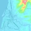
Galas topographic map

Click on the map to display elevation.

About this map

Name: Galas topographic map, elevation, terrain.

Location: Galas, Dipolog, Zamboanga del Norte, Zamboanga Peninsula, 7100, Philippines (8.52758 123.08195 8.76601 123.35552)

Average elevation: 24 m

Minimum elevation: -3 m

Maximum elevation: 573 m

Other topographic maps

Click on a map to view its topography, its elevation and its terrain.
Dicayas

Philippines > Zamboanga del Norte > Dipolog

Average elevation: 24 m

Minaog

Philippines > Zamboanga del Norte > Dipolog

Average elevation: 21 m

Dicayas

Philippines > Zamboanga del Norte > Dipolog

Average elevation: 24 m

Gear up for your next adventure:

🧊Personal Water Filters - Drink safely from mountain streams marked on your map
🍲Portable Camping Stoves - Fast-boiling stoves for hot meals on remote topographic survey trips
📸Action Camera Chest Mounts - Record your ascent following topographic paths hands-free
🌄Outdoor Binoculars - Compact binoculars for landscape observation
⌚GPS Outdoor Watches - Watches with GPS tracking for hiking and exploration

As an Amazon Associate, this site earns from qualifying purchases at no extra cost to you.