Geolocate

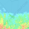
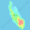
Gamay topographic map

Click on the map to display elevation.

About this map

Name: Gamay topographic map, elevation, terrain.

Location: Gamay, Northern Samar, Eastern Visayas, Philippines (12.34674 125.26151 12.42674 125.34151)

Average elevation: 16 m

Minimum elevation: -3 m

Maximum elevation: 146 m

Other topographic maps

Click on a map to view its topography, its elevation and its terrain.
Catubig River

Philippines > Northern Samar

Average elevation: 38 m

Catarman

Philippines > Northern Samar

Average elevation: 57 m

Biri

Philippines > Northern Samar

Average elevation: 1 m

Capul

Philippines > Northern Samar

Average elevation: 5 m

Sitio Rabbit

Philippines > Northern Samar > Victoria

Average elevation: 27 m

Tarnate

Philippines > Northern Samar > San Vicente

Average elevation: 27 m

Catubig River

Philippines > Northern Samar > Del Pilar

Average elevation: 38 m

Catarman

Philippines > Northern Samar

Average elevation: 57 m

Sitio Alegria

Philippines > Northern Samar > San Isidro

Average elevation: 18 m

Capul Island

Philippines > Northern Samar > Capul

Average elevation: 14 m

Capul

Philippines > Northern Samar

Average elevation: 5 m

Capul Island

Philippines > Northern Samar > Capul

Average elevation: 14 m

Palanit

Philippines > Northern Samar

Average elevation: 52 m

Catarman

Philippines > Northern Samar

Average elevation: 51 m

Gear up for your next adventure:

🦟Anti-Midge & Tick Repellent - Vital for hiking in the Scottish Highlands during summer
🍲Portable Camping Stoves - Fast-boiling stoves for hot meals on remote topographic survey trips
🧘Folding Sit Mats - Dry and warm seat for map-reading breaks on damp ground
🛰️Outdoor GPS Navigation - Navigation devices for remote and off-grid areas
🧤Hiking Gloves - Warm and durable gloves for cold-weather walks

As an Amazon Associate, this site earns from qualifying purchases at no extra cost to you.