
Stradone ED topographic map
Interactive map
Click on the map to display elevation.
About this map
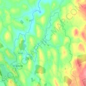
Name: Stradone ED topographic map, elevation, terrain.
Location: Stradone ED, Larah, County Cavan, H12 NV06, Ireland (53.97342 -7.23579 54.01342 -7.19579)
Average elevation: 101 m
Minimum elevation: 69 m
Maximum elevation: 154 m