
Sort topographic map
Interactive map
Click on the map to display elevation.
About this map
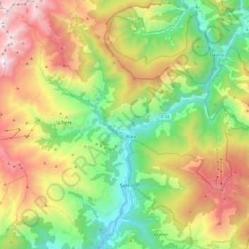
Name: Sort topographic map, elevation, terrain.
Location: Sort, Pallars-Supérieur, Lérida, Catalogne, 25560, Espagne (42.37007 1.01643 42.53092 1.20457)
Average elevation: 1,541 m
Minimum elevation: 653 m
Maximum elevation: 2,885 m