Geolocate

Santa Claus topographic map

Click on the map to display elevation.

About this map
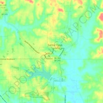
Name: Santa Claus topographic map, elevation, terrain.

Location: Santa Claus, Spencer County, Indiana, 47579, United States (38.08941 -86.97974 38.15691 -86.89805)

Average elevation: 143 m

Minimum elevation: 121 m

Maximum elevation: 180 m

Other topographic maps

Click on a map to view its topography, its elevation and its terrain.

Lincoln City

United States > Indiana > Spencer County

Average elevation: 137 m

Huffman

United States > Indiana > Spencer County

Average elevation: 141 m

Gear up for your next adventure:

📚UK Hiking Guidebooks - Detailed route descriptions for the Lake District, Peaks, and Highlands
🥾Women's Waterproof Hiking Boots - High-performance trekking boots designed for all-weather comfort
🔋Rechargeable Batteries - Eco-friendly power for headlamps and older GPS units
🧴Tick Removal Tools - Small, essential health tool for UK woodland and moorland
🔋Solar Power Banks - Keep your GPS and phone charged during multi-day expeditions

As an Amazon Associate, this site earns from qualifying purchases at no extra cost to you.