Geolocate

Milagro topographic map

Click on the map to display elevation.

About this map

Name: Milagro topographic map, elevation, terrain.

Location: Milagro, Erriberagoiena / Ribera Alta, Navarre, Spain (42.21192 -1.82001 42.26707 -1.71731)

Average elevation: 290 m

Minimum elevation: 266 m

Maximum elevation: 401 m

Other topographic maps

Click on a map to view its topography, its elevation and its terrain.
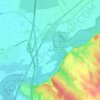
El Soto

Spain > Navarre > Erriberagoiena / Ribera Alta > Marcilla

Average elevation: 308 m

Gear up for your next adventure:

🔦LED Camping Lanterns - Illumination for reading maps inside your tent at night
👟Waterproof Leg Gaiters - Keep mud and water out of your boots in boggy terrain
🥾Women's Waterproof Hiking Boots - High-performance trekking boots designed for all-weather comfort
🧊Insulated Flasks - Keeps drinks hot or cold during hikes
🥤Collapsible Water Bottles - Save space in your rucksack as you consume your water

As an Amazon Associate, this site earns from qualifying purchases at no extra cost to you.