Geolocate

Center topographic map

Click on the map to display elevation.

About this map
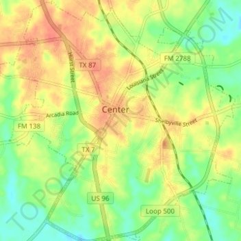
Name: Center topographic map, elevation, terrain.

Location: Center, Shelby County, Texas, 75935, United States (31.76645 -94.21010 31.81895 -94.14955)

Average elevation: 99 m

Minimum elevation: 75 m

Maximum elevation: 120 m

Other topographic maps

Click on a map to view its topography, its elevation and its terrain.
Mount Herman

United States > Texas > Shelby County

Average elevation: 124 m

Gear up for your next adventure:

🎿Telescopic Trekking Poles - Reduces knee strain on steep topographic descents
👟Heavy Duty Boot Laces - Always carry a spare for your hiking footwear
💧Hydration Reservoirs - Convenient water bladders for hands-free drinking on the move
🥾Hiking Boot Waterproofing Wax - Maintain the lifespan of your leather trekking boots
🧰Survival Kits - Emergency tools for remote environments

As an Amazon Associate, this site earns from qualifying purchases at no extra cost to you.