
Reus topographic map
Interactive map
Click on the map to display elevation.
About this map
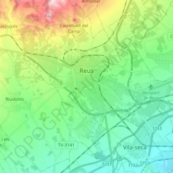
Name: Reus topographic map, elevation, terrain.
Location: Reus, Baix Camp, Tarragona, Catalonia, 43201, Spain (41.10238 1.05753 41.19021 1.19135)
Average elevation: 119 m
Minimum elevation: 8 m
Maximum elevation: 411 m
Other topographic maps
Click on a map to view its topography, its elevation and its terrain.
Vandellòs i l'Hospitalet de l'Infant
Vandellòs i l'Hospitalet de l'Infant, Baix Camp, Tarragona, Catalonia, 43891, Spain
Average elevation: 281 m