Geolocate

L'Assomption topographic map

Click on the map to display elevation.

About this map
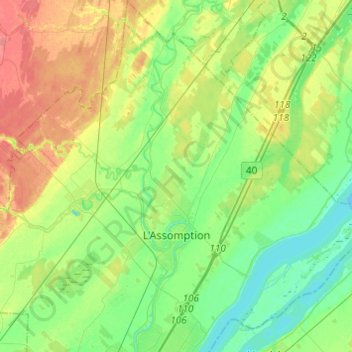
Name: L'Assomption topographic map, elevation, terrain.

Location: L'Assomption, L'Assomption (MRC), Lanaudière, Quebec, Canada (45.77405 -73.49568 45.94354 -73.34502)

Average elevation: 23 m

Minimum elevation: 2 m

Maximum elevation: 57 m

Gear up for your next adventure:

🧦Hiking Socks - Breathable socks designed to prevent blisters on long walks
🔋Rechargeable Batteries - Eco-friendly power for headlamps and older GPS units
🧣Fleece Neck Warmers - Extra insulation for winter topographic surveys
🎒Hiking Backpacks - Comfortable backpacks for day hikes and multi-day treks
👖Packable Overtrousers - Quick-deploy rain protection for legs in sudden storms

As an Amazon Associate, this site earns from qualifying purchases at no extra cost to you.