
Santa Fe topographic map
Click on the map to display elevation.
Santa Fe
With a population of 87,505 at the 2020 census, it is the fourth-largest city in New Mexico. It is also the county seat of Santa Fe County. Its metropolitan area is part of the Albuquerque–Santa Fe–Las Vegas combined statistical area, which had a population of 1,162,523 in 2020. The city was founded in 1610 as the capital of Nuevo México, replacing the previous capital, San Juan de los Caballeros (near modern Española) at San Gabriel de Yungue-Ouinge, which makes it the oldest state capital in the United States. It is also at the highest altitude of any of the U.S. state capitals, with an elevation of 7,199 feet (2,194 m).
About this map
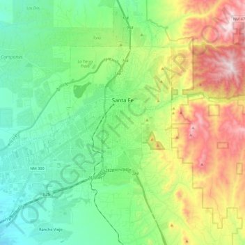
Name: Santa Fe topographic map, elevation, terrain.
Location: Santa Fe, Santa Fe County, New Mexico, United States (35.58804 -106.11216 35.75462 -105.89418)
Average elevation: 2,221 m
Minimum elevation: 1,915 m
Maximum elevation: 2,862 m
Other topographic maps
Click on a map to view its topography, its elevation and its terrain.