Geolocate

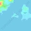
Tando topographic map

Click on the map to display elevation.

About this map

Name: Tando topographic map, elevation, terrain.

Location: Tando, Nueva Valencia, Guimaras, Western Visayas, Philippines (10.44786 122.46865 10.48786 122.50865)

Average elevation: 5 m

Minimum elevation: -2 m

Maximum elevation: 45 m

Other topographic maps

Click on a map to view its topography, its elevation and its terrain.

Gear up for your next adventure:

💧Hydration Reservoirs - Convenient water bladders for hands-free drinking on the move
🚶Walking Pedometers - Simple distance tracking for casual trail walkers
🧭Emergency Beacons - Safety beacons for remote outdoor locations
🧤Thermal Touchscreen Gloves - Stay warm while operating your GPS or smartphone camera
👕Merino Base Layers - Natural temperature regulation for cold weather hiking and camping

As an Amazon Associate, this site earns from qualifying purchases at no extra cost to you.