
Kahramankazan topographic map
Interactive map
Click on the map to display elevation.
About this map
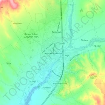
Name: Kahramankazan topographic map, elevation, terrain.
Location: Kahramankazan, Ankara, İç Anadolu Bölgesi, Turquia (40.16603 32.64053 40.24603 32.72053)
Average elevation: 923 m
Minimum elevation: 850 m
Maximum elevation: 1,125 m