
La Piaggia topographic map
Interactive map
Click on the map to display elevation.
About this map
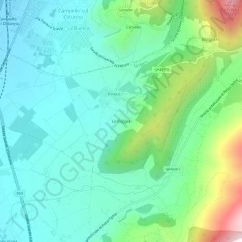
Name: La Piaggia topographic map, elevation, terrain.
Location: La Piaggia, Spolète, Perugia, Ombrie, 06049, Italie (42.78509 12.76703 42.82509 12.80703)
Average elevation: 422 m
Minimum elevation: 222 m
Maximum elevation: 1,036 m
Other topographic maps
Click on a map to view its topography, its elevation and its terrain.