Geolocate

Condres topographic map

Click on the map to display elevation.

About this map

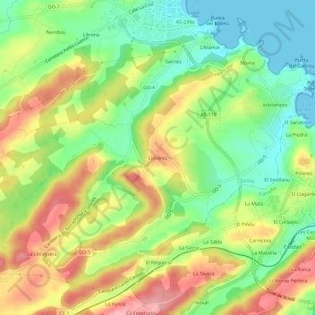
Name: Condres topographic map, elevation, terrain.

Location: Condres, Luanco / Lluanco, Gozón, Asturias, 33440, Spain (43.57508 -5.81624 43.61508 -5.77624)

Average elevation: 56 m

Minimum elevation: -1 m

Maximum elevation: 123 m

Gear up for your next adventure:

🧥Waterproof Hiking Jackets - Rain protection for walking in all weather conditions
🥾Men's Waterproof Hiking Boots - Durable footwear with deep lugs for muddy and rocky UK terrains
🧥Breathable Waterproof Jackets - Essential rain protection for the unpredictable British climate
🌄Outdoor Binoculars - Compact binoculars for landscape observation
🛰️Handheld GPS Devices - Reliable GPS units for hiking and outdoor navigation

As an Amazon Associate, this site earns from qualifying purchases at no extra cost to you.