
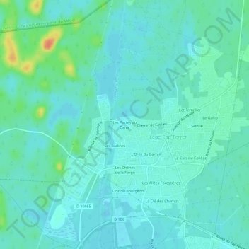
Les Portes du Canal topographic map
Interactive map
Click on the map to display elevation.
About this map
Name: Les Portes du Canal topographic map, elevation, terrain.
Average elevation: 9 m
Minimum elevation: 0 m
Maximum elevation: 42 m
Other topographic maps
Click on a map to view its topography, its elevation and its terrain.
Le Four
France > Nouvelle-Aquitaine > Gironde > Lège-Cap-Ferret
Le Four, Lège-Cap-Ferret, Arcachon, Gironde, Nouvelle-Aquitaine, France métropolitaine, France
Average elevation: 3 m
Les Jacquets
France > Nouvelle-Aquitaine > Gironde > Lège-Cap-Ferret
Les Jacquets, Lège-Cap-Ferret, Arcachon, Gironde, Nouvelle-Aquitaine, France métropolitaine, France
Average elevation: 4 m