
Kalalé topographic map
Interactive map
Click on the map to display elevation.
About this map
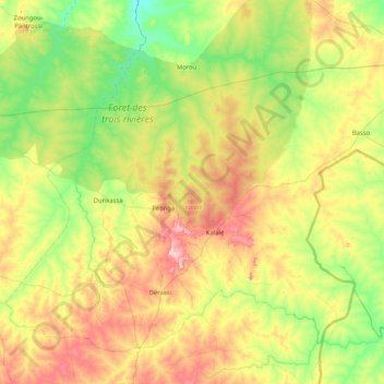
Name: Kalalé topographic map, elevation, terrain.
Location: Kalalé, Borgou, Benin (10.09330 3.02015 10.65059 3.84334)
Average elevation: 323 m
Minimum elevation: 228 m
Maximum elevation: 497 m
Other topographic maps
Click on a map to view its topography, its elevation and its terrain.