Geolocate

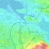
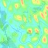
Markree Castle topographic map

Click on the map to display elevation.

About this map

Name: Markree Castle topographic map, elevation, terrain.

Location: Markree Castle, L36058, Collooney ED, Sligo Municipal Borough District, County Sligo, Connacht, F91 R2T9, Ireland (54.17395 -8.46200 54.17439 -8.46075)

Average elevation: 36 m

Minimum elevation: 17 m

Maximum elevation: 65 m

Other topographic maps

Click on a map to view its topography, its elevation and its terrain.
Knocknarea

Ireland > County Sligo

Average elevation: 104 m

Sligo

Ireland > County Sligo

Average elevation: 21 m

Rosses Point

Ireland > County Sligo

Average elevation: 4 m

Ballintogher

Ireland > County Sligo

Average elevation: 64 m

Rosses Upper

Ireland > County Sligo

Average elevation: 8 m

Carrowntemple

Ireland > County Sligo

Average elevation: 129 m

Doonbeakin

Ireland > County Sligo

Average elevation: 106 m

Bartragh

Ireland > County Sligo

Average elevation: 6 m

Carrowbunnaun

Ireland > County Sligo

Average elevation: 36 m

Carrownanty

Ireland > County Sligo

Average elevation: 74 m

Rosses Point

Ireland > County Sligo

Average elevation: 8 m

Bearlough

Ireland > County Sligo

Average elevation: 72 m

Gear up for your next adventure:

🎒Backpack Rain Covers - Universal waterproof covers to protect your gear from downpours
🔥Reusable Hand Warmers - Maintain dexterity in your fingers for precise map handling
🛑Emergency Bivvy Bags - Heat-reflective survival bags for unexpected nights out
🔦Head Torches - Hands-free lighting for hiking and camping
🧼Camping Hygiene Kits - Compact hygiene essentials for outdoor stays

As an Amazon Associate, this site earns from qualifying purchases at no extra cost to you.