
Thank you for supporting this site ❤️
Make a donation
Make a donation
Gear up for your next adventure:
As an Amazon Associate, this site earns from qualifying purchases at no extra cost to you.
Plaz topographic map
Click on the map to display elevation.
Thank you for supporting this site ❤️
Make a donation
Make a donation
Gear up for your next adventure:
As an Amazon Associate, this site earns from qualifying purchases at no extra cost to you.
About this map
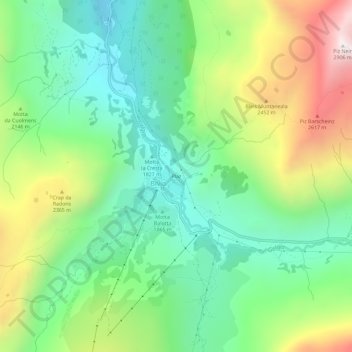
Name: Plaz topographic map, elevation, terrain.
Location: Plaz, Bivio, Surses, Albula, Grisons, 7457, Switzerland (46.44957 9.63269 46.48957 9.67269)
Average elevation: 2,085 m
Minimum elevation: 1,667 m
Maximum elevation: 2,862 m
Thank you for supporting this site ❤️
Make a donation
Make a donation
Gear up for your next adventure:
As an Amazon Associate, this site earns from qualifying purchases at no extra cost to you.