
Make a donation
Gear up for your next adventure:
As an Amazon Associate, this site earns from qualifying purchases at no extra cost to you.
Peckforton Castle topographic map
Click on the map to display elevation.
Make a donation
Gear up for your next adventure:
As an Amazon Associate, this site earns from qualifying purchases at no extra cost to you.
Peckforton Castle
Peckforton Castle stands in a wooded area near the northern extremity of Peckforton Hills at an elevation of 469.2 feet (143 m). The land falls steeply downwards to the north and the west of the castle, and the Sandstone Trail, a long-distance footpath, runs along the base of these slopes. The ruins of Beeston Castle stand on a separate steeply sloping hill 0.75 miles (1 km) to the north. The village of Beeston is 0.75 miles (1 km) to the northeast and the village of Peckforton is 1 mile (2 km) to the southeast. Access is via the road between Beeston and Peckforton.
Make a donation
Gear up for your next adventure:
As an Amazon Associate, this site earns from qualifying purchases at no extra cost to you.
About this map
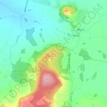
Name: Peckforton Castle topographic map, elevation, terrain.
Average elevation: 83 m
Minimum elevation: 31 m
Maximum elevation: 198 m
Cheshire West and Chester trails, hiking, mountain biking, running and outdoor activities
Make a donation
Gear up for your next adventure:
As an Amazon Associate, this site earns from qualifying purchases at no extra cost to you.