
Lac du Bonheur topographic map
Interactive map
Click on the map to display elevation.
About this map
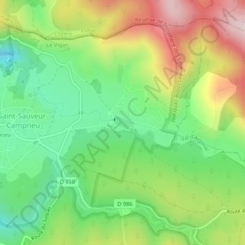
Name: Lac du Bonheur topographic map, elevation, terrain.
Average elevation: 1,169 m
Minimum elevation: 1,030 m
Maximum elevation: 1,368 m
Other topographic maps
Click on a map to view its topography, its elevation and its terrain.
Abîme de Bramabiau
France > Occitanie > Gard > Saint-Sauveur-Camprieu
Abîme de Bramabiau, Chemin de Bramabiau, Saint-Sauveur-Camprieu, Le Vigan, Gard, Occitanie, France métropolitaine, 30750, France
Average elevation: 1,134 m