
Palmer topographic map
Interactive map
Click on the map to display elevation.
About this map
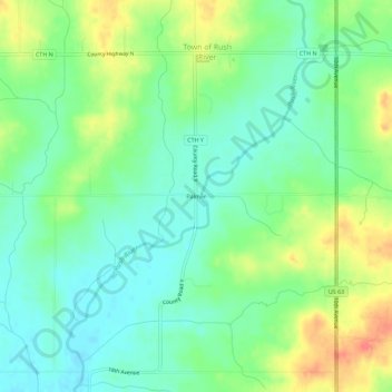
Name: Palmer topographic map, elevation, terrain.
Average elevation: 334 m
Minimum elevation: 314 m
Maximum elevation: 369 m
Other topographic maps
Click on a map to view its topography, its elevation and its terrain.
New Richmond
United States > Wisconsin > Saint Croix County
New Richmond, Saint Croix County, Wisconsin, 54017, United States
Average elevation: 303 m
Town of Hudson
United States > Wisconsin > Saint Croix County > Town of Hudson
Town of Hudson, Saint Croix County, Wisconsin, 54016, United States
Average elevation: 281 m
Hudson
United States > Wisconsin > Saint Croix County > Hudson
Hudson, Saint Croix County, Wisconsin, 54016-9303, United States
Average elevation: 242 m