
Thank you for supporting this site ❤️
Make a donation
Make a donation
Gear up for your next adventure:
As an Amazon Associate, this site earns from qualifying purchases at no extra cost to you.
Øyulvstad topographic map
Click on the map to display elevation.
Thank you for supporting this site ❤️
Make a donation
Make a donation
Gear up for your next adventure:
As an Amazon Associate, this site earns from qualifying purchases at no extra cost to you.
About this map
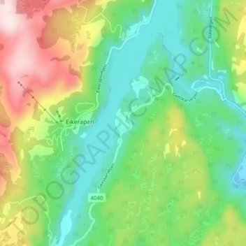
Name: Øyulvstad topographic map, elevation, terrain.
Location: Øyulvstad, Eikerapen, Åseral, Agder, 4544, Norway (58.51968 7.35344 58.55968 7.39344)
Average elevation: 393 m
Minimum elevation: 232 m
Maximum elevation: 697 m
Thank you for supporting this site ❤️
Make a donation
Make a donation
Gear up for your next adventure:
As an Amazon Associate, this site earns from qualifying purchases at no extra cost to you.