Geolocate

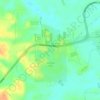
Curupira topographic map

Click on the map to display elevation.

About this map

Name: Curupira topographic map, elevation, terrain.

Location: Curupira, Iranduba, Região Geográfica Imediata de Manaus, Região Geográfica Intermediária de Manaus, Amazonas, Região Norte, Brasil (-3.26697 -60.10969 -3.22697 -60.06969)

Average elevation: 35 m

Minimum elevation: 10 m

Maximum elevation: 61 m

Other topographic maps

Click on a map to view its topography, its elevation and its terrain.
Igarapé Acajituba

Brasil > Amazonas > Iranduba

Average elevation: 35 m

Praia do Açutuba

Brasil > Amazonas > Iranduba

Average elevation: 24 m

Cacau Pirera

Brasil > Amazonas > Iranduba

Average elevation: 27 m

Gear up for your next adventure:

🧊Personal Water Filters - Drink safely from mountain streams marked on your map
👕Technical Hiking Tees - Moisture-management for high-exertion climbs
🔦Head Torches - Hands-free lighting for hiking and camping
🧭Professional Hiking Compasses - High-precision liquid-filled compasses for map reading and orientation
💧Hydration Reservoirs - Convenient water bladders for hands-free drinking on the move

As an Amazon Associate, this site earns from qualifying purchases at no extra cost to you.