
Thank you for supporting this site ❤️
Make a donation
Make a donation
Gear up for your next adventure:
As an Amazon Associate, this site earns from qualifying purchases at no extra cost to you.
Manjirón topographic map
Click on the map to display elevation.
Thank you for supporting this site ❤️
Make a donation
Make a donation
Gear up for your next adventure:
As an Amazon Associate, this site earns from qualifying purchases at no extra cost to you.
About this map
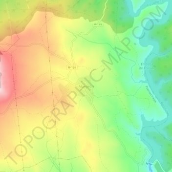
Name: Manjirón topographic map, elevation, terrain.
Location: Manjirón, Puentes Viejas, Comunidad de Madrid, 28754, España (40.94540 -3.60288 40.98540 -3.56288)
Average elevation: 995 m
Minimum elevation: 871 m
Maximum elevation: 1,140 m
Thank you for supporting this site ❤️
Make a donation
Make a donation
Gear up for your next adventure:
As an Amazon Associate, this site earns from qualifying purchases at no extra cost to you.