Geolocate

Jasper topographic map

Click on the map to display elevation.

About this map

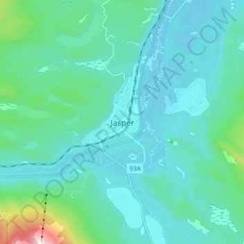
Name: Jasper topographic map, elevation, terrain.

Location: Jasper, Municipality of Jasper, Alberta, T0E 1E0, Canada (52.83523 -118.12243 52.91523 -118.04243)

Average elevation: 1,175 m

Minimum elevation: 1,017 m

Maximum elevation: 2,262 m

Gear up for your next adventure:

🕶️Polarized Sunglasses - Reduces glare from snow and water when reading terrain
📸Action Camera Chest Mounts - Record your ascent following topographic paths hands-free
🌄Compact Monoculars - Lightweight optics for hiking
🎿Telescopic Trekking Poles - Reduces knee strain on steep topographic descents
🐕Hiking Dog Harnesses - Rugged harnesses for taking your companion on mountain trails

As an Amazon Associate, this site earns from qualifying purchases at no extra cost to you.