Geolocate

Olney topographic map

Click on the map to display elevation.

About this map
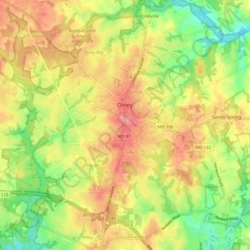
Name: Olney topographic map, elevation, terrain.

Location: Olney, Montgomery County, Maryland, United States (39.10895 -77.11047 39.18515 -77.02751)

Average elevation: 136 m

Minimum elevation: 90 m

Maximum elevation: 175 m

Other topographic maps

Click on a map to view its topography, its elevation and its terrain.

Anscroft

United States > Maryland > Montgomery County > Olney

Average elevation: 138 m

Gear up for your next adventure:

🧣Fleece Neck Warmers - Extra insulation for winter topographic surveys
🥾Hiking Boots - Waterproof and durable boots for long-distance hiking in the UK
🧊Personal Water Filters - Drink safely from mountain streams marked on your map
🌄Compact Monoculars - Lightweight optics for hiking
📻Hand-Crank Emergency Radios - Stay updated on weather warnings in remote areas

As an Amazon Associate, this site earns from qualifying purchases at no extra cost to you.