
Абрит topographic map
Interactive map
Click on the map to display elevation.
About this map
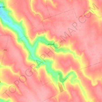
Name: Абрит topographic map, elevation, terrain.
Location: Абрит, Крушари, Oblast de Dobritch, Bulgarie (43.87833 27.77063 43.92842 27.85435)
Average elevation: 184 m
Minimum elevation: 107 m
Maximum elevation: 211 m
Other topographic maps
Click on a map to view its topography, its elevation and its terrain.
Владимирово
Владимирово, Obchtina Dobritchka, Oblast de Dobritch, Bulgarie
Average elevation: 232 m