
Thank you for supporting this site ❤️
Make a donation
Make a donation
Gear up for your next adventure:
As an Amazon Associate, this site earns from qualifying purchases at no extra cost to you.
Ospedaletti topographic map
Click on the map to display elevation.
Thank you for supporting this site ❤️
Make a donation
Make a donation
Gear up for your next adventure:
As an Amazon Associate, this site earns from qualifying purchases at no extra cost to you.
About this map
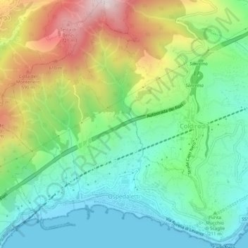
Name: Ospedaletti topographic map, elevation, terrain.
Location: Ospedaletti, Imperia, Liguria, 18014, Italy (43.79502 7.69711 43.82873 7.74031)
Average elevation: 268 m
Minimum elevation: -2 m
Maximum elevation: 783 m
Thank you for supporting this site ❤️
Make a donation
Make a donation
Gear up for your next adventure:
As an Amazon Associate, this site earns from qualifying purchases at no extra cost to you.