
Sg. Dua Fall topographic map
Interactive map
Click on the map to display elevation.
About this map
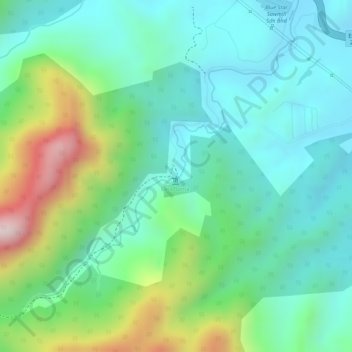
Name: Sg. Dua Fall topographic map, elevation, terrain.
Location: Sg. Dua Fall, Bentong, Pahang, Malaysia (3.43435 101.98614 3.43445 101.98624)
Average elevation: 217 m
Minimum elevation: 76 m
Maximum elevation: 550 m
Other topographic maps
Click on a map to view its topography, its elevation and its terrain.