
Thank you for supporting this site ❤️
Make a donation
Make a donation
Gear up for your next adventure:
As an Amazon Associate, this site earns from qualifying purchases at no extra cost to you.
Cirpstene topographic map
Click on the map to display elevation.
Thank you for supporting this site ❤️
Make a donation
Make a donation
Gear up for your next adventure:
As an Amazon Associate, this site earns from qualifying purchases at no extra cost to you.
About this map
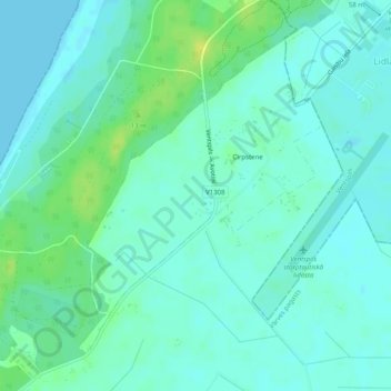
Name: Cirpstene topographic map, elevation, terrain.
Location: Cirpstene, Vārves pagasts, Ventspils novads, Latvia (57.34728 21.51128 57.36910 21.54218)
Average elevation: 6 m
Minimum elevation: 0 m
Maximum elevation: 18 m
Thank you for supporting this site ❤️
Make a donation
Make a donation
Gear up for your next adventure:
As an Amazon Associate, this site earns from qualifying purchases at no extra cost to you.