
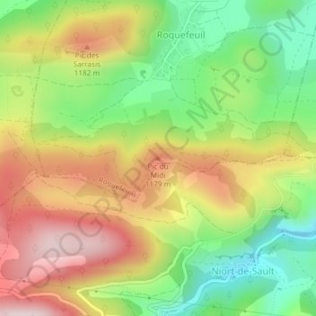
Pic du Midi topographic map
Interactive map
Click on the map to display elevation.
About this map
Name: Pic du Midi topographic map, elevation, terrain.
Average elevation: 1,032 m
Minimum elevation: 824 m
Maximum elevation: 1,266 m
Other topographic maps
Click on a map to view its topography, its elevation and its terrain.
La Bénague
France > Occitanie > Aude > Roquefeuil
La Bénague, Roquefeuil, Limoux, Aude, Occitanie, France métropolitaine, 11340, France
Average elevation: 940 m