
Wringinputih topographic map
Click on the map to display elevation.
About this map
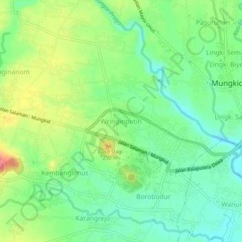
Name: Wringinputih topographic map, elevation, terrain.
Location: Wringinputih, Magelang, Central Java, Java, 56511, Indonesia (-7.60777 110.17033 -7.56777 110.21033)
Average elevation: 266 m
Minimum elevation: 224 m
Maximum elevation: 393 m
Other topographic maps
Click on a map to view its topography, its elevation and its terrain.