
`Adhur topographic map
Interactive map
Click on the map to display elevation.
About this map
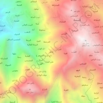
Name: `Adhur topographic map, elevation, terrain.
Location: `Adhur, Kusmah, Kusmah District, Raymah Governorate, Yemen (14.54933 43.60644 14.58933 43.64644)
Average elevation: 2,168 m
Minimum elevation: 1,233 m
Maximum elevation: 2,870 m
Other topographic maps
Click on a map to view its topography, its elevation and its terrain.
Al Ja`lalah
Yemen > Raymah Governorate > Kusmah
Al Ja`lalah, Kusmah, Kusmah District, Raymah Governorate, Yemen
Average elevation: 2,370 m