
Haulashore Island topographic map
Interactive map
Click on the map to display elevation.
About this map
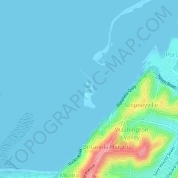
Name: Haulashore Island topographic map, elevation, terrain.
Location: Haulashore Island, Britannia Heights, Nelson, New Zealand (-41.26932 173.25581 -41.26342 173.25908)
Average elevation: 13 m
Minimum elevation: -1 m
Maximum elevation: 111 m
Other topographic maps
Click on a map to view its topography, its elevation and its terrain.
Broads Park
New Zealand > Nelson > Nelson
Broads Park, Nelson South, Nelson, New Zealand
Average elevation: 85 m