
Bitburg topographic map
Click on the map to display elevation.
About this map
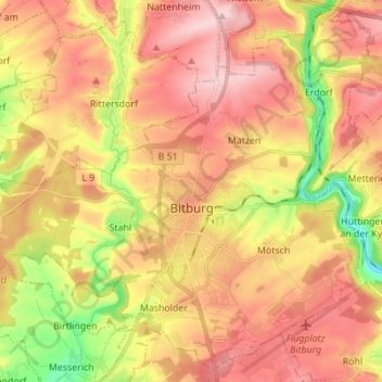
Name: Bitburg topographic map, elevation, terrain.
Location: Bitburg, Eifelkreis Bitburg-Prüm, Rhineland-Palatinate, Germany (49.93519 6.45161 50.01873 6.58925)
Average elevation: 326 m
Minimum elevation: 202 m
Maximum elevation: 416 m
Other topographic maps
Click on a map to view its topography, its elevation and its terrain.
Haubendell
Germany > Rhineland-Palatinate > Eifelkreis Bitburg-Prüm > Karlshausen > Haubendell
Average elevation: 451 m