
Thank you for supporting this site ❤️
Make a donation
Make a donation
Gear up for your next adventure:
As an Amazon Associate, this site earns from qualifying purchases at no extra cost to you.
Luwu topographic map
Click on the map to display elevation.
Thank you for supporting this site ❤️
Make a donation
Make a donation
Gear up for your next adventure:
As an Amazon Associate, this site earns from qualifying purchases at no extra cost to you.
About this map
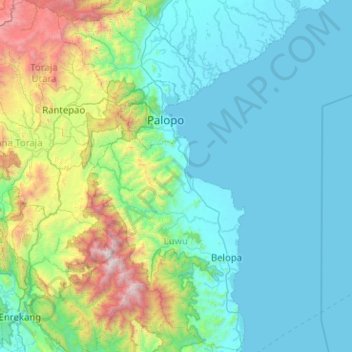
Name: Luwu topographic map, elevation, terrain.
Location: Luwu, Marinding, South Sulawesi, Sulawesi, Indonesia (-3.66741 119.88350 -2.65718 120.42069)
Average elevation: 515 m
Minimum elevation: 0 m
Maximum elevation: 3,414 m
Thank you for supporting this site ❤️
Make a donation
Make a donation
Gear up for your next adventure:
As an Amazon Associate, this site earns from qualifying purchases at no extra cost to you.