Geolocate

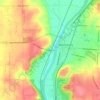
Centerville topographic map

Click on the map to display elevation.

About this map
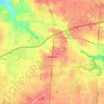
Name: Centerville topographic map, elevation, terrain.

Location: Centerville, Montgomery County, Ohio, United States (39.59062 -84.20869 39.67385 -84.09909)

Average elevation: 287 m

Minimum elevation: 226 m

Maximum elevation: 323 m

Other topographic maps

Click on a map to view its topography, its elevation and its terrain.

Woodbourne

United States > Ohio > Montgomery County

Average elevation: 291 m

Bridgeport

United States > Ohio > Montgomery County > Miamisburg

Average elevation: 243 m

Hearthstone

United States > Ohio > Montgomery County > Dayton

Average elevation: 273 m

Greenmont

United States > Ohio > Montgomery County > Kettering

Average elevation: 282 m

Cornell Heights

United States > Ohio > Montgomery County > Dayton

Average elevation: 256 m

Avondale

United States > Ohio > Montgomery County > Riverside

Average elevation: 238 m

Dayton

United States > Ohio > Montgomery County > Dayton

Average elevation: 270 m

Oakdale

United States > Ohio > Montgomery County > Kettering

Average elevation: 297 m

Patterson

United States > Ohio > Montgomery County > Dayton

Average elevation: 233 m

Fort McKinley

United States > Ohio > Montgomery County > Dayton

Average elevation: 273 m

Shakertown

United States > Ohio > Montgomery County > Kettering

Average elevation: 282 m

Oakland

United States > Ohio > Montgomery County > Dayton

Average elevation: 269 m

North Riverdale

United States > Ohio > Montgomery County > Dayton

Average elevation: 254 m

Gear up for your next adventure:

🛌Insulated Sleeping Mats - Crucial thermal protection when sleeping on cold, uneven ground
🌄Compact Monoculars - Lightweight optics for hiking
🧰First Aid Kits - Essential safety kits for outdoor activities
🦯Walking Poles - Supportive poles for long-distance walking
🔋Power Banks - Portable chargers for long outdoor trips

As an Amazon Associate, this site earns from qualifying purchases at no extra cost to you.