
Puerto Plata topographic map
Interactive map
Click on the map to display elevation.
About this map
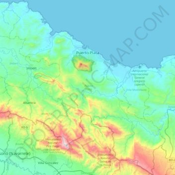
Name: Puerto Plata topographic map, elevation, terrain.
Location: Puerto Plata, Dominican Republic (19.51209 -70.88912 19.90841 -70.50732)
Average elevation: 227 m
Minimum elevation: 0 m
Maximum elevation: 1,220 m
Other topographic maps
Click on a map to view its topography, its elevation and its terrain.