Geolocate

Gilgit River topographic map

Click on the map to display elevation.

About this map

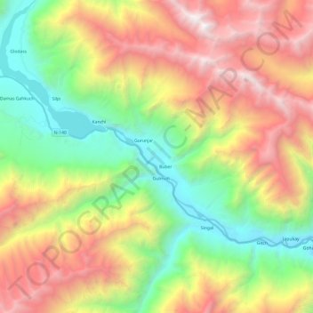
Name: Gilgit River topographic map, elevation, terrain.

Location: Gilgit River, Gulmuti, Gilgit-Baltistan, Pakistan (36.09893 73.73266 36.21112 73.97366)

Average elevation: 3,210 m

Minimum elevation: 1,760 m

Maximum elevation: 5,194 m

Gear up for your next adventure:

🔭Compact Hiking Binoculars - Lightweight optics for scouting terrain and spotting wildlife
GPS Outdoor Watches - Watches with GPS tracking for hiking and exploration
🧢Hiking Hats - Sun and weather protection for outdoor walks
🌄Compact Monoculars - Lightweight optics for hiking
👖Hiking Trousers - Durable trousers designed for rough terrain

As an Amazon Associate, this site earns from qualifying purchases at no extra cost to you.