Geolocate

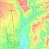
Kibala topographic map

Click on the map to display elevation.

About this map

Name: Kibala topographic map, elevation, terrain.

Location: Kibala, Malungon, Sarangani, Soccsksargen, 9503, Philippines (6.36126 125.15460 6.40126 125.19460)

Average elevation: 528 m

Minimum elevation: 337 m

Maximum elevation: 926 m

Other topographic maps

Click on a map to view its topography, its elevation and its terrain.
Buayan River

Philippines > Sarangani > Malungon

Average elevation: 149 m

Gear up for your next adventure:

📚UK Hiking Guidebooks - Detailed route descriptions for the Lake District, Peaks, and Highlands
☕Insulated Travel Mugs - Keep drinks hot while surveying the landscape from a summit
🥾Women's Waterproof Hiking Boots - High-performance trekking boots designed for all-weather comfort
🧷Tenacious Repair Tape - Instant fix for torn tents, jackets, or dry bags
🛰️Handheld GPS Devices - Reliable GPS units for hiking and outdoor navigation

As an Amazon Associate, this site earns from qualifying purchases at no extra cost to you.