Geolocate

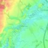
Fischbek topographic map

Click on the map to display elevation.

About this map

Name: Fischbek topographic map, elevation, terrain.

Location: Fischbek, Elmenhorst, Bargteheide-Land, Kreis Stormarn, Schleswig-Holstein, 23869, Germany (53.74413 10.26659 53.78413 10.30659)

Average elevation: 37 m

Minimum elevation: 9 m

Maximum elevation: 62 m

Other topographic maps

Click on a map to view its topography, its elevation and its terrain.

Ammersbek

Germany > Schleswig-Holstein > Kreis Stormarn

Average elevation: 36 m

Heilshoop

Germany > Schleswig-Holstein > Kreis Stormarn

Average elevation: 28 m

Glinde

Germany > Schleswig-Holstein > Kreis Stormarn

Average elevation: 33 m

Gear up for your next adventure:

📍Handheld GPS Navigators - Reliable satellite navigation for hiking and off-road exploration
🧤Waterproof Overmitts - Extreme weather protection for hikers and mountaineers
📻Hand-Crank Emergency Radios - Stay updated on weather warnings in remote areas
⛺Camping Shelters - Emergency and lightweight shelters for outdoor use
🕶️Glacier Goggles - Maximum protection for high-altitude snow topography

As an Amazon Associate, this site earns from qualifying purchases at no extra cost to you.