Geolocate

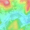
Bridge of Muick topographic map

Click on the map to display elevation.

About this map

Name: Bridge of Muick topographic map, elevation, terrain.

Location: Bridge of Muick, Ballater, Aberdeenshire, Scotland, AB35 5SN, United Kingdom (57.01975 -3.06717 57.05975 -3.02717)

Average elevation: 303 m

Minimum elevation: 187 m

Maximum elevation: 605 m

Aberdeenshire trails, hiking, mountain biking, running and outdoor activities

Other topographic maps

Click on a map to view its topography, its elevation and its terrain.
Gear up for your next adventure:

🔥Emergency Fire Starters - Reliable ignition tools for survival situations in damp conditions
🛑Emergency Bivvy Bags - Heat-reflective survival bags for unexpected nights out
🖼️Topographic Map Art - Decorative 3D-effect posters of famous UK peaks and regions
🥾Trekking Poles - Poles to improve stability on uneven terrain
📍Handheld GPS Navigators - Reliable satellite navigation for hiking and off-road exploration

As an Amazon Associate, this site earns from qualifying purchases at no extra cost to you.