Geolocate

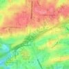
Patton Chapel topographic map

Click on the map to display elevation.

About this map

Name: Patton Chapel topographic map, elevation, terrain.

Location: Patton Chapel, Hoover, Jefferson County, Alabama, 35216, United States (33.37428 -86.81804 33.41428 -86.77804)

Average elevation: 165 m

Minimum elevation: 120 m

Maximum elevation: 259 m

Other topographic maps

Click on a map to view its topography, its elevation and its terrain.
Howard Lake

United States > Alabama > Jefferson County > Hoover

Average elevation: 167 m

Gear up for your next adventure:

🧴Sport Sunscreen Sticks - High-protection sunblock that won't run into your eyes on the trail
📍Handheld GPS Navigators - Reliable satellite navigation for hiking and off-road exploration
📐Altimeters & Barometers - Tools for measuring altitude and air pressure
🚲Cycling GPS Computers - Track elevation and topographic routes on two wheels
🔦Keychain LED Torches - Emergency backup light for finding gear in your pack

As an Amazon Associate, this site earns from qualifying purchases at no extra cost to you.