
Jarabacoa topographic map
Interactive map
Click on the map to display elevation.
Jarabacoa
Jarabacoa has a Tropical rainforest climate (Köppen climate classification Af ). Due to its high elevation in the interior it has warm days and lower temperatures at nights during most of the year, and temperate days and colder nights during winter months. Because of its climate, visitors have christened Jarabacoa as "The City of Everlasting Spring." Rain is abundant during most all the year.
About this map
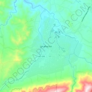
Name: Jarabacoa topographic map, elevation, terrain.
Location: Jarabacoa, La Vega, 41200, Dominican Republic (19.08141 -70.68321 19.16141 -70.60321)
Average elevation: 615 m
Minimum elevation: 446 m
Maximum elevation: 1,203 m