Geolocate

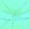
Gunja topographic map

Click on the map to display elevation.

About this map

Name: Gunja topographic map, elevation, terrain.

Location: Gunja, Općina Gunja, Vukovar-Srijem County, Croatia (44.85172 18.81337 44.91107 18.91210)

Average elevation: 86 m

Minimum elevation: 76 m

Maximum elevation: 116 m

Other topographic maps

Click on a map to view its topography, its elevation and its terrain.
Ilok

Croatia > Vukovar-Srijem County

Average elevation: 119 m

Babina Greda

Croatia > Vukovar-Srijem County

Average elevation: 84 m

Gunja

Croatia > Vukovar-Srijem County

Average elevation: 84 m

Gear up for your next adventure:

🔦Waterproof LED Headlamps - Hands-free lighting for evening treks and emergency navigation
🧥Softshell Jackets - Breathable jackets for active outdoor use
🥾Men's Waterproof Hiking Boots - Durable footwear with deep lugs for muddy and rocky UK terrains
🧺Microfibre Travel Towels - Fast-drying and compact towels for wild swimming and camping
🛌Sleeping Bags - Warm and packable sleeping bags for outdoor nights

As an Amazon Associate, this site earns from qualifying purchases at no extra cost to you.