
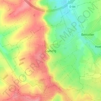
Gisingen topographic map
Interactive map
Click on the map to display elevation.
About this map
Name: Gisingen topographic map, elevation, terrain.
Average elevation: 338 m
Minimum elevation: 292 m
Maximum elevation: 382 m
Other topographic maps
Click on a map to view its topography, its elevation and its terrain.
Oberdorf
Frankreich > Grand Est > Mosel
Oberdorf, Forbach-Bolchen, Mosel, Grand Est, Metropolitanes Frankreich, 57320, Frankreich
Average elevation: 309 m
Amenweiler
Frankreich > Grand Est > Mosel
Amenweiler, Metz, Mosel, Grand Est, Metropolitanes Frankreich, 57360, Frankreich
Average elevation: 191 m
Metz
Frankreich > Grand Est > Mosel
Metz, Mosel, Grand Est, Metropolitanes Frankreich, Frankreich
Average elevation: 196 m