
Thank you for supporting this site ❤️
Make a donation
Make a donation
Gear up for your next adventure:
As an Amazon Associate, this site earns from qualifying purchases at no extra cost to you.
Dimbulah topographic map
Click on the map to display elevation.
Thank you for supporting this site ❤️
Make a donation
Make a donation
Gear up for your next adventure:
As an Amazon Associate, this site earns from qualifying purchases at no extra cost to you.
About this map
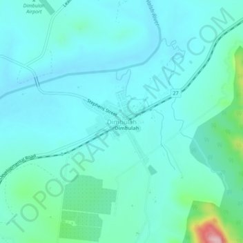
Name: Dimbulah topographic map, elevation, terrain.
Location: Dimbulah, Mareeba Shire, Queensland, Australia (-17.16969 145.09039 -17.12969 145.13039)
Average elevation: 476 m
Minimum elevation: 444 m
Maximum elevation: 653 m
Thank you for supporting this site ❤️
Make a donation
Make a donation
Gear up for your next adventure:
As an Amazon Associate, this site earns from qualifying purchases at no extra cost to you.