Platteville topographic map
Click on the map to display elevation.
Platteville
Platteville is the largest city in Grant County, Wisconsin, United States. The population was 11,836 at the 2020 census. It is located atop the greater Platte River valley in the southern Driftless Region of Wisconsin, an area known for its karst topography and rolling hills. It is home to the University of Wisconsin–Platteville. It is the principal city of the Platteville micropolitan statistical area, which has an estimated population of 51,938.
About this map
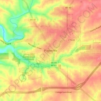
Name: Platteville topographic map, elevation, terrain.
Location: Platteville, Grant County, Wisconsin, 53818, United States (42.71397 -90.50631 42.75469 -90.42960)
Average elevation: 295 m
Minimum elevation: 243 m
Maximum elevation: 327 m
Other topographic maps
Click on a map to view its topography, its elevation and its terrain.