Geolocate

Pilton topographic map

Click on the map to display elevation.

About this map

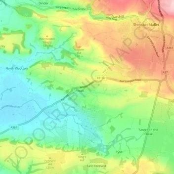
Name: Pilton topographic map, elevation, terrain.

Location: Pilton, Somerset, England, United Kingdom (51.14234 -2.64109 51.19201 -2.53578)

Average elevation: 90 m

Minimum elevation: 7 m

Maximum elevation: 225 m

Somerset trails, hiking, mountain biking, running and outdoor activities

Gear up for your next adventure:

🧥Packable Down Jackets - Lightweight warmth that compresses small in your bag
🧣Neck Gaiters - Versatile protection against wind and cold
🕶️Polarized Sunglasses - Reduces glare from snow and water when reading terrain
🎒Hiking Daypacks - Compact backpacks ideal for short hikes and excursions
🐕Dog Hiking Gear - Equipment for hiking safely with dogs

As an Amazon Associate, this site earns from qualifying purchases at no extra cost to you.