
Rechthalten topographic map
Interactive map
Click on the map to display elevation.
About this map
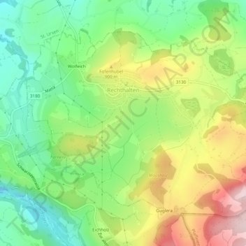
Name: Rechthalten topographic map, elevation, terrain.
Location: Rechthalten, Sensebezirk, Freiburg, 1718, Schweiz (46.75066 7.22137 46.77557 7.26908)
Average elevation: 854 m
Minimum elevation: 723 m
Maximum elevation: 1,043 m